Dales Trails
|
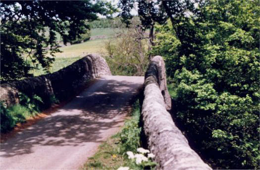
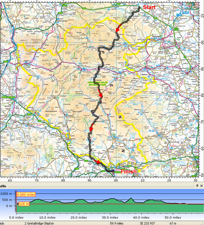
TRANS-DALES TRAIL 2 Greta Bridge to SkiptonNow available as a FREE download - see below "A PRE-RAMBLE" Britain's Long-distance Footpaths present a rather daunting challenge for many people. I believe a walk should be a pleasurable experience, not a painful slog. The pace should allow time for savouring the delights of the countryside, time for pints of beer, time for cups of tea. This was my thinking when I devised my first "Trans-Dales Trail", west to east, from Ingleton to Ripon, in 1995. Hard on the heels of that first venture came this north to south "Trans-Dales Trail 2", from Greta Bridge to Skipton. The same criteria apply, with each day being ideally no more than about 12 miles, the Trail can be leisurely completed in five days with a minimum of four nights B & B accommodation. The weight to be carried in your rucksac need not be more than about 28lbs and this should be within the capabilities of most people - see Peter's article near the back of the booklet. For "Trail 2" I have picked a route through this very popular area which avoids the more heavily used paths. Many of the tracks are steeped (and steep!) in history, with some going back to Roman times whilst others were old Drovers Roads and packhorse tracks. By contrast, the last few miles follow the towpath of the Leeds & Liverpool Canal into Skipton. This brings you right into the centre of this bustling town without having to resort to walking through the streets. Trans-Dales Trail 2" starts at Greta Bridge in County Durham, just off the A66 trans-Pennine road from Scotch Corner to Penrith, about 3 miles from Barnard Castle. From there the trail heads south across remote countryside, forest, and moor into Arkengarthdale and Swaledale. Then it's up onto Oxnop Scar and over into Wensleydale, on past Semer Water and over Stake Moss into Wharfedale. Crossing into Littondale the Trail climbs Yew Cogar Scar then descends into Malham, via the Cove. With the hills now behind you the River Aire is followed to Airton, then on to Gargrave via Bell Busk. A leisurely ramble along the canal bank brings you into Skipton. Peter and I completed this walk in June 1996, and that route is described in detail in the booklet. Good walking Arnold Underwood & Peter Tomkinson So, as the Cliffords of Skipton would say, "Desormais" - henceforth and don't look back (except to admire the views).
Click here and follow the instructions to view or save the document - Trans-Dales Trail 2
|
Arnold Underwood